Adventure: Yosemite National Park
After a great July 4th week in Berkeley and San Francisco, we left the Bay Area on a Friday afternoon for a weekend in Yosemite with our buds Ann and Matt. We made a pit stop in the historic gold rush town Mariposa, CA to buy provisions for the weekend and explore some of the small shops, then made our way into the park. Considering we booked this trip just a few weeks out, we counted ourselves pretty lucky to be able to find an available condo for the four of us in Yosemite West, a community that's just within the park and only 30 minutes from the Valley. Hotels and campsites in the Valley, we learned, book up months and months in advance.
Speaking of Yosemite Valley, we caught a stunning glimpse of Tunnel View just before sunset on our drive up to our condo.
This is how I feel about sitting in hours of Friday afternoon traffic out of the Bay Area.
Since we only had one full day to experience the park, our strategy was to pack in as much as possible on a full-day hike. We woke up very early Saturday morning (around 5am), made bagels and PB&J sandwiches, and filled up our water bottles. This is probably a good time to mention that if you're planning an full-day hike (or any hike) in Yosemite in the summer (or anytime), you should hydrate as well as possible the day before, and carry more water than you think you’ll need.
We decided to take on one of the most strenuous routes in the park -- second only to summiting Half Dome -- a 14-mile combination of Four Mile Trail from the Valley floor up to Glacier Point, Panorama Trail from Glacier Point back down to the Valley, and the back half of Mist Trail past the popular Nevada Fall and Vernal Fall.
We made it to the Four Mile Trailhead just before 7am. There was abundant parking on the side of the street, although we later learned that this was maybe not the best parking strategy. Four Mile Trail is actually a misnomer -- it's five miles up to Glacier Point, with about 3200ft in elevation gain. We knew this would be one of the toughest stretches of our hike, and temperatures threatened to climb to the 90s by mid-day. Thankfully, we were on the shady side of the mountain, on fresh legs, and the cooler morning air for most of the hike. It took us about three hours keeping a pretty moderate pace. Through some combination of our early morning start and this being a less popular trail, we only saw about a dozen other hikers the whole way up.
Four Mile Trail starts as a flat path into the woods, but curves steeply (top left) as you start ascending up into the mountains via tight switchbacks.
Although our entire day of hiking offered spectacular views, the amazing vistas on Four Mile Trail were some of the very best. I'd heard that pictures of Yosemite are a poor substitute for seeing it in real life, and that became more and more apparent with every twist and turn up to Glacier Point. Ann was also nice enough to hang back with me when my pace slowed considerably after the DSLR came out.
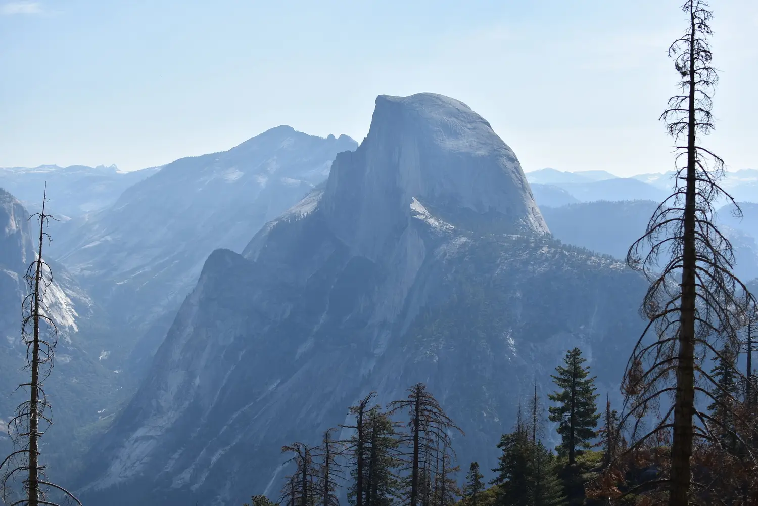
The Glacier Point summit, which we hit just after 10am, was an ideal mid-morning pit stop. It was already starting to get crowded (though not nearly as busy as some of the sights closer to the Valley, we’d later discover). There were still ample spots to sit in the shade and relax. There are also restrooms, water fountains, and a small store that sells just about anything you'd need for day-hikes, backpacking trips, or keeping small children entertained. Collectively, we bought beef jerky, 5-hour Energy shots, Red Bull, granola bars, a blister kit, sunscreen, and a hat. We rested here for about half an hour, people-watched, and hiked the quarter-mile Glacier Point trail to pose for pictures in front of beautiful Half Dome.
We traveled onward from Glacier Point away from the crowd on Panorama Trail. This was not a misnomer -- the views of the glacial-cut valley on the way down as spectacular. We hiked down through a canyon, into a forest, and past a beautiful overlook for Illilouette Falls. We eventually found ourselves at the creek over Illilouette Falls where we stopped for lunch. We sat on the rocks in the river and enjoyed Chef Matt's only-slightly-smushed PB&J sandwiches.
The next part of the hike up the Illilouette Gorge was tougher and more uphill than we expected, particularly in the mid-day sun. After we crossed the bridge over Illilouette Creek, we climbed 700 feet in about a mile and a half, and the uneven terrain took a toll on our tired legs and weak ankles. But, what goes up must go down, and we were soon descending back through the forest to Nevada Fall (about 4.5 miles from Glacier Point). The sights and sounds of the rushing river and the "top of the waterfall" vantage point made this an idyllic place to rest and snap some pictures.
Nevada Fall is the last stop on the out-and-back Mist Trail, which begins down in the Valley and is one of the most popular in the Park. The relative solitude we'd enjoyed for most of the day was replaced by a pretty big crowd at Nevada Fall, and it only got busier as we continued onward. It wasn't just hoards of people we encountered, though. We were soon greeted by endless steps down the side of Nevada Fall, which were tough on our tired knees. We were incredibly glad not to be traveling in the opposite direction (which was the far more popular route), especially in full sun and 90+ degree heat. The view alongside Nevada Fall was somehow even more impressive than the view from the top.
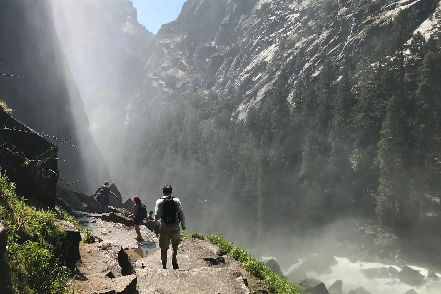
We learned how the Mist Trail got its name at the bottom of Nevada Fall, although we were too eager, worked too hard, and scrambled over way too many slippery rocks to feel the chilly spray at the base of the waterfall. We realized very shortly thereafter that the mist assault is virtually impossible to avoid further down the trail, but the detour and subsequent rest were welcome and well worth it.
Ann didn't come on this part of the adventure. She is not about this life.
Then it was on to Vernal Fall, where we hit the "8 hour" mark. Our pace had slowed considerably due to fatigue, frequent pit stops, and the trails becoming increasingly busier. We walked down very slick steps beside Vernal Fall, which were dicey on our Jello legs.
We made it to the Valley floor just after 5pm - a full 10 hours from when we set off. My GPS clocked us in a little over 16 miles for the day. Unfortunately, our journey was not over... it took us another 2+ hours to get back to Yosemite West between two long shuttle lines, then an even longer line of cars to leave the Valley. I'm not sure what we could have done differently to avoid the crowds or traffic without adding on many extra miles to the hike, but it was definitely more hassle than we bargained for, and we were pretty pooped on the drive back up out of the Valley.
Tiredness and soreness from the day before ruled out any chance for a sunrise hike at Mirror Lake Sunday morning, which was on my must-see list. Instead, we made breakfast and went down to the Valley for a leisurely stroll on the Valley View trail with stops at Cathedral Beach, Sentinel Beach, and the Swinging Bridge. This gave us a chance to take in some of the classic views we missed on Saturday, like El Capitan (below) and Yosemite Falls.
In spite of all we were able to cram in in a short time period, we left on Sunday afternoon feeling like we'd barely scraped the surface of this beautiful national park. We'd love to car camp (or maybe pack-in!) next time, stay for at least a week, and really get to enjoy everything Yosemite has to offer!


